
About the Business
Combining the best of non-invasive geophysical survey technology, with conventional survey techniques, we are able to provide comprehensive underground information. Non-invasive underground mapping surveys are used to detect and map underground hazards and features including buried services, utilities, obstructions and voids.
Based in Hull and providing nationwide coverage, the services offered are proven to make a real difference to Consultants, Contractors and Local Authorities in the delivery of both capital projects and maintenance operations.
Underground Mapping is typically carried out to enhance the risk management process, improve hazard plans and avoid damage to existing buried plant/apparatus, personnel and minimise excavation. We provide accurate information on the location of underground features which can enable safer and more practicable design solutions to be acheived.
Location & Hours
Carlisle Street
Write a Review


Similar Businesses in East Riding of Yorkshire

Latitude Surveys

Chris Wilson Associates

Dixon Associates

Recently Viewed Listing
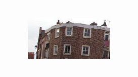
Maybridge Commercial
Maybridge Commercial is a independent practice of Chartered Surveyors ...